11:30 AM | *Major cold wave next week and perhaps even the first threat of snow for the interior Mid-Atlantic*
Paul Dorian
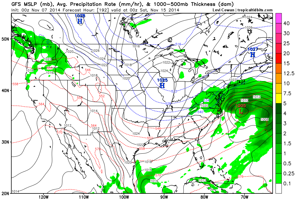 [00Z GFS surface forecast map for next Friday night; courtesy "tropicaltidbits.com"]
Discussion
The weather pattern across North America is about to undergo some significant changes over the next several days led in part by the development of a superstorm near the Bering Strait and this will play a role in multiple Arctic air outbreaks into the central and eastern US during the remainder of November. The remains of Typhoon Nuri are moving away from Japan today and into the Northern Pacific Ocean and will undergo explosive intensification over the next 12 hours as it closes in on the Bering Strait region between western Alaska and Russia. In fact, this storm may deepen enough by early tomorrow to rival all-time atmospheric low pressure records in that part of the world - perhaps as low as 925 millibars (27.28 inches!!!).
The development of a deep upper-level trough of low pressure in this part of the Northern Pacific associated with this unfolding superstorm will have ripple effects to the overall pattern downstream in coming days. To begin with, upper-level ridging will form along the west coast of North America in the next few days and then upper-level troughing will develop across the central and eastern US later next week. This type of pattern will allow for the movement of Arctic air from northern Canada into the northern US by the middle of next week. Indeed, one major Arctic air outbreak will plunge into the northern US by around Tuesday of next week and then this cold air mass will spread to the Mid-Atlantic coastline at mid-week. Shortly after the cold air establishes itself in the central and eastern US, the upper-level trof in that region will likely begin to deepen and the result could very well be the formation of a storm near the Mid-Atlantic coastline. With cold air in place and the potential development of a storm, this could turn out to be the first snow threat of the season in parts of the interior Mid-Atlantic region in the late Thursday/Friday time frame of next week. Stay tuned – the fun season is just getting underway.
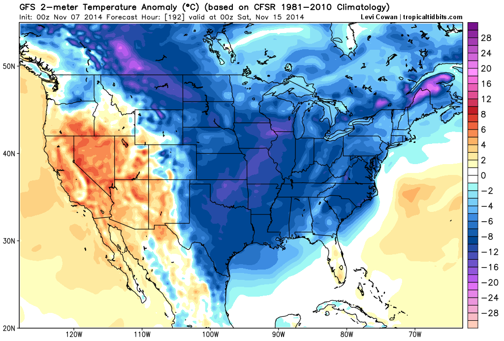 [00Z GFS 2-meter temperature anomaly forecast map for next Friday night showing widespread colder-than-normal air in the eastern 2/3 of the nation; courtesy "tropicaltidbits.com"]