4:30 PM | Potential Northeast US storm early next week
Paul Dorian
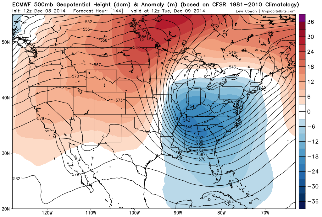 [12Z Euro 500 mb forecast map for next Tuesday morning; courtesy tropicaltidbits.com]
Discussion
The North America 500 millibar upper air pattern is likely to evolve over the next several days to become quite favorable for the development of a strong storm near the Northeast US coastline early next week. Strong upper-level (blocking) high pressure is likely to extend from the Northern Plains to southeastern Canada by early next week at the same time an upper-level trough of low pressure is digging into the Southeast US. This type of pattern should allow for the intensification of surface low pressure off the east coast early next week at the same time cold air builds up across New England and southeastern Canada anchored by strong surface high pressure. It is way too early to tell if this will result in a “New York City/New England” type of storm or if it could have an impact farther south along the I-95 corridor. Also, it is too early to tell if the threat for anything frozen will be confined to interior Northeast US locations only.
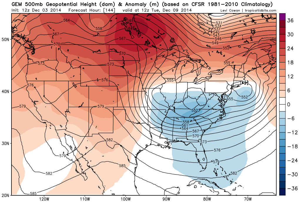 [12Z GEM 500 mb forecast map for next Tuesday morning; courtesy tropicaltidbits.com]
There currently is much disagreement amongst the many computer forecast models and that can be easily seen by comparing the 500 millibar forecast maps for next Tuesday morning from each of three models. The European and Canadian models (top, middle) generally agree with each other at 500 millibars and both feature impressive and digging troughs of low pressure into the southeastern US (blue) with blocking high pressure extending across the northern states into southeastern Canada (red). Meanwhile, the GFS operational model forecast (below) has a fairly unimpressive upper level trough in the same time period. Stay tuned, the overall weather pattern favors the Euro and Canadian model forecast solutions.
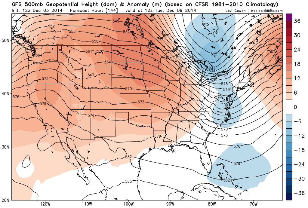 [12Z GFS 500 mb forecast map for next Tuesday morning; courtesy tropicaltidbits.com]
Paul Dorian/Meteorologist VencoreWeather.com now on Facebook, Twitter and liveweatherblogs.com paul.b.dorian@vencore.com