2:45 PM | Scattered snow showers accompany Arctic blast...an update on Sunday's coastal storm (a tricky forecast)...Comet Lovejoy
Paul Dorian
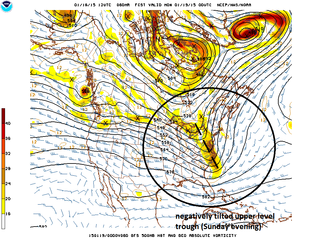 [12Z GFS 500 millibar forecast map for Sunday evening; courtesy NOAA]
Discussion
Scattered snow showers today near Philly, NYC, brutal tonight Arctic air is pouring into the region this afternoon on gusty NW winds and scattered snow showers are accompanying this influx of cold air. These scattered snow showers are possible over the next few hours; especially, in the northern and western suburbs of Philly and NYC where visibilities can drop quickly for a brief time. Temperatures tonight will plunge way down into the low-to-middle teens in most of these suburban locations and will stay well below normal on Saturday.
Coastal storm on Sunday with a freezing rain threat at the onset A coastal storm will develop near the Carolina coastline on Sunday at the same time another area of low pressure will be crossing the Great Lakes region. The developing coastal storm will spread significant precipitation into the I-95 corridor region from DC-to-Philly-to-NYC during Sunday morning and then that will continue in the afternoon and evening. The upper-level trough associated with this coastal storm will start to negatively tilt late Sunday (above) and this has the potential to enhance the precipitation for a period of time most from around Philly to points north and east. Ultimately, the southern low pressure system absorbs the northern low and becomes quite a storm for New England by late Sunday night and early Monday.
As far as temperatures and precipitation type are concerned – the tricky part of the forecast - Sunday will be cold at the start, but there should be some warm advection at low-levels of the atmosphere resulting in eventual above-freezing surface temperatures. The upper atmosphere, however, will tend to gradually cool down on Sunday and, all in all, cold air will stay pretty close to the I-95 corridor during much of the storm and will wrap in quickly behind as it departs to the northeast. As a result, freezing rain is possible at the onset; especially, in higher elevation areas to the north and west of I-95. Also, there can be a brief changeover to snow and/or sleet towards the end of the storm as it pulls away to the northeast. It stays moderately cold next week and we’ll likely have to deal with a “clipper” type of system at mid-week with some snow possible in parts of the Mid-Atlantic region.
Comet Lovejoy Finally, after the scattered snow showers dissipate late today across PA, NJ and NY, skies are likely to clear nicely tonight and it may be a good opportunity to view Comet Lovejoy (although very cold) which is now reaching its maximum brightness. The comet is now in the vicinity of the Pleiades star cluster (see image below).
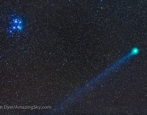 [Recent image of Comet Lovejoy; courtesy spaceweather.com]