1:00 PM | **Snow on Friday with an increase in snowfall estimates**
Paul Dorian
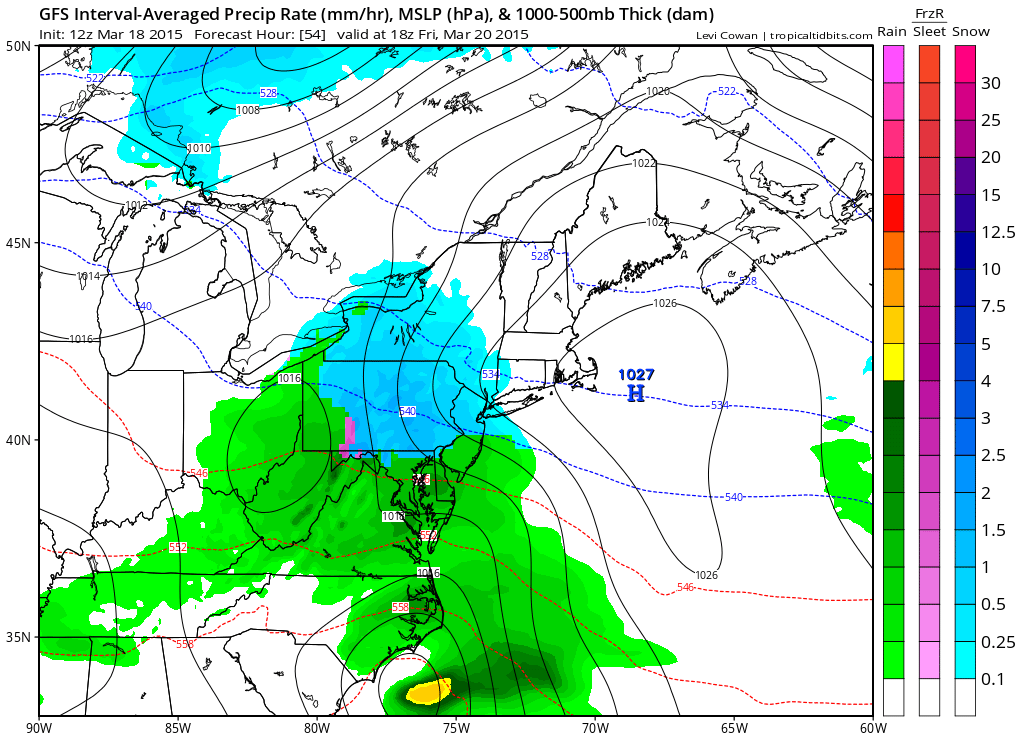 [12Z GFS forecast map for early Friday afternoon (blue=snow, green=rain); map courtesy "tropicaltidbits.com", NOAA]
Discussion
Our return to a winter-like weather pattern has begun with the latest influx of cold air and now attention turns to a very good chance of accumulating wet snow on Friday in the I-95 corridor. With cold air in place, low pressure will organize along the Mid-Atlantic coastline early Friday and then gradually intensify as it moves to the northeast. “Elevation” typically plays a critical role in late season snowfall amounts and this could lead to a wider range compared to normal on Friday across metro regions with respect to overall accumulations. The highest accumulations will likely take place on grassy surfaces in elevated locations to the north and west of the big cities and there certainly can be slippery conditions on the roadways.
Here is the breakdown for the I-95 corridor:
DC: Snow is likely to break out after midnight and continue into early Friday morning. The snow is then likely to mix with and change to plain rain later in the morning, but not before there are accumulations on the order of a coating to 3 inches with the higher amounts in that range on grassy surfaces in elevated locations to the west and north of the District.
Philly: Snow is likely to break out right around daybreak on Friday and continue through much of the day. The snow can mix with rain later in the day; especially, in Philly and nearby points to the south and east, but it could remain as all snow well to the north and west of Philly. Accumulations on the order of 2-5 inches are possible with the higher amounts in that range on grassy surfaces in elevated locations to the north and west of Philly.
NYC: Snow is likely to break out early Friday and continue through much of the day. The snow can mix with rain later in the day in NYC and nearby points to the south and east, but it is likely to remain as all snow to the north and west of the NYC metro region. Accumulations on the order of 2-5 inches are possible with the higher amounts in that range on grassy surfaces in elevated locations to the west of the NYC metro region.
One final note, it’ll turn milder on Saturday causing some snow melt, but then another cold air mass will arrive early next week and there may actually be another snow threat in the I-95 corridor by the middle of next week.
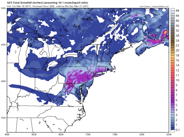 [12Z GFS snowfall amounts for the upcoming storm; map courtesy "tropicaltidbits.com", NOAA]