1:00 PM | Weekend heavy rain threat with a tropical connection
Paul Dorian

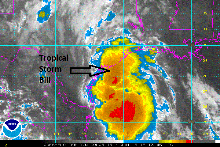
 [Latest colorized IR satellite image; courtesy Penn State eWall]
Discussion
Tropical Storm Bill is pushing ashore at this hour over the central Texas coastline bringing with it torrential rainfall and renewed concerns for flooding. The latest colorized infrared satellite image (above) shows an extensive area of high clouds (reds, oranges) over the Gulf of Mexico associated with strong thunderstorm activity near the tropical system. The strongest winds associated with Bill are likely to occur to the east of the storm track where gusts can reach 65 mph or so as the system moves inland. The heaviest rainfall likely to fall over the next 24 hours or so will be on areas that suffered through flooding rains in May such as eastern Texas, northwestern Louisiana and southeastern Oklahoma. Some of these locations could receive more than a foot of rain on top of the 1-2 feet of rain experienced there back in May.
After the storm moves inland, it’ll transition to a non-tropical system, but flooding rainfall will continue in its path. Bill’s immediate moisture field is likely to advance to the north and east as it gets influenced by southwesterly upper-level winds. In fact, there is already an impressive moisture field that extends from the Texas coastline to the Mid-Atlantic region as indicated below by the blueish-green colors on the following wind flow and precipitable water map. Note the circulation center at the Texas coastline associated with Tropical Storm Bill.
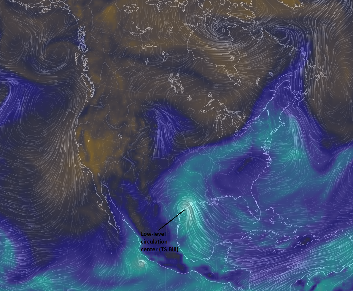 [Low-level wind flow and precipitable water; courtesy earth.nullschool.net]
There is the chance that heavy rainfall from the remains of Tropical Storm Bill will reach the Mid-Atlantic region sometime this weekend. The latest GFS computer model forecast (below) depicts an area of heavy rainfall in the Mississippi Valley by early Friday afternoon (top, circled area) that then progresses to the I-95 corridor region by early Sunday morning (bottom, circled area). Stay tuned.
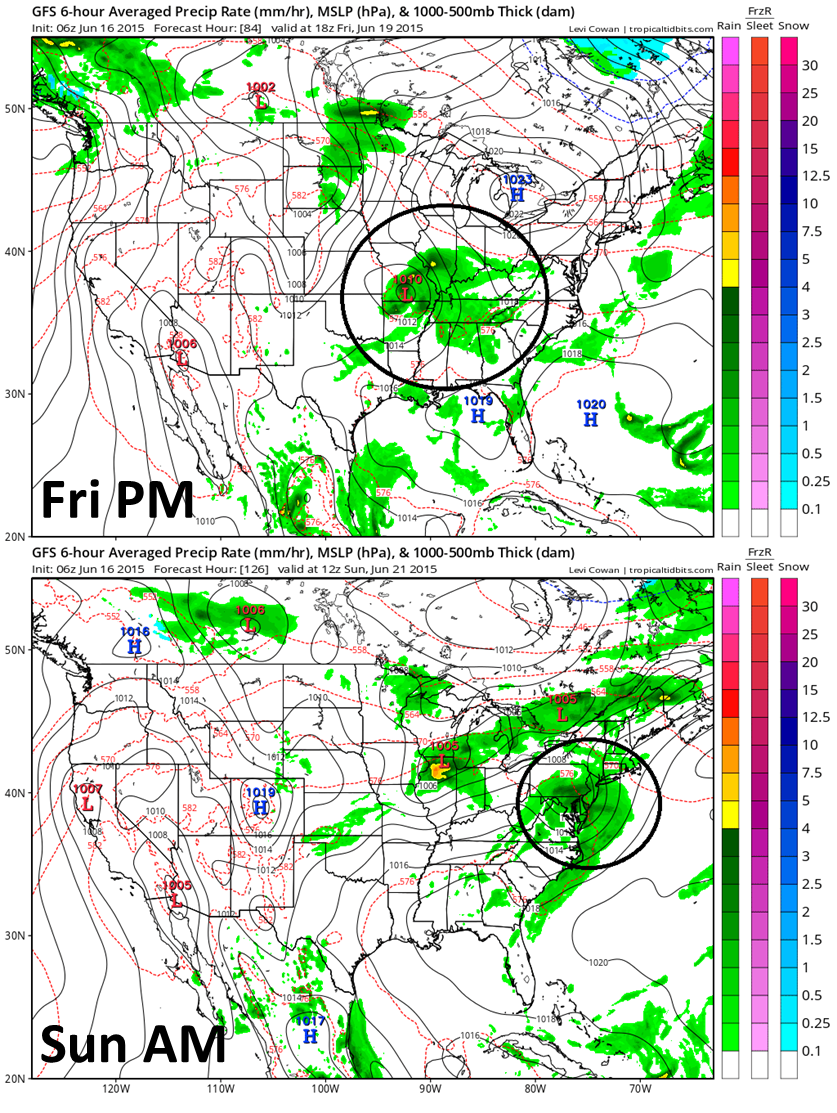 [GFS forecast maps for early Friday PM (Top) and early Sunday morning (bottom); courtesy NOAA]