Friday 11:00 AM | **Snow coverage and intensity now increasing in Mid-Atlantic region as jet-streak induced upward motion arrives**
Paul Dorian

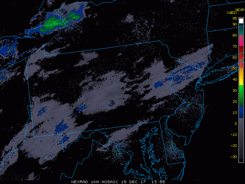
Radar echoes are increasing in coverage and intensity at mid-day as jet-streak induced upward motion arrives in region; courtesy College of DuPage, NOAA
Overview
This is going to be the third accumulating snow even this week in parts of the I-95 corridor which is pretty impressive for any time of the winter season, but particularly notable for the first half of December. Low pressure will intensify off the Mid-Atlantic coastline this afternoon and snow is now breaking out in many areas in this entrenched cold air mass. Given the very cold ground-level conditions, slippery spots are very likely to form rather quickly this afternoon on many roadways and average accumulations of a dusting to a couple of inches are likely in along the I-95 corridor with even higher amounts at the NJ coastline and in isolated spots around here.

00Z GFS forecast map of 250 mb winds at 1 PM this afternoon featuring a powerful jet streak in the Mid-Atlantic (shown in red); courtesy NOAA/EMC
Details
Radar echoes during the early morning hours have been rather unimpressive, but are now expanding noticeably as jet streak-induced upward motion arrives in the general region and this is rapidly enhancing overall snow coverage and intensity. Low pressure near the North Carolina coastline this morning will intensify as it heads northeast to a position off the New Jersey coastline by this evening.

High-resolution (HRRR) forecast map for 3 PM this afternoon featuring snow (in blue) in the DC-to-Philly-to-NYC corridor; map courtesy NOAA/EMC, tropicaltidbits.com
The snow should begin in most areas between 11 AM and 2 PM with average accumulations from a dusting to a couple of inches likely by early tonight in all metro regions from DC-to-Philly-to-NYC. Even higher snowfall amounts of 3-4 inches are possible at the New Jersey coastline and cannot be ruled out in isolated spots in the metro regions along Route I-95. Many roadways will become slippery in a hurry with this snowfall given the very cold ground-level conditions. There may be some rain and graupel mixed in with the snow in areas to the south of the PA/MD border during the next couple of hours (e.g., in the DC metro area). The snow should pull away rather quickly early tonight and it’ll stay cold on Saturday; however, there will be a noticeably milder stretch of weather for the Sunday, Monday and Tuesday time period.
Meteorologist Paul Dorian
Vencore, Inc.
vencoreweather.com
AM video discussion: