
12:20 PM | *Very wet pattern setting up for the next week with multiple rounds of showers and thunderstorms…storms late today/early tonight and again late tomorrow can be on the strong-to-severe side*
Paul Dorian
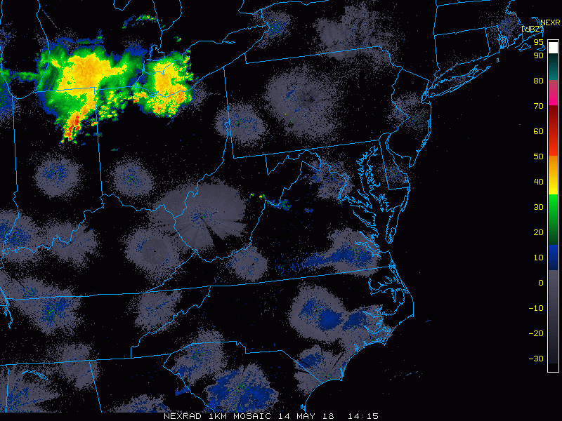
Mid-day radar loop with a batch of showers and thunderstorms to monitor across northern Ohio as they push to the south and east; courtesy NOAA, College of DuPage
Overview
There will not be a drought anytime soon in the Mid-Atlantic region or even in much of the eastern third of the nation as a very wet pattern is unfolding for the next week or so that will likely result in excessive amounts of rainfall. There will be multiple rounds of showers and thunderstorms during the next several days and some of the storms that occur can be on the strong-to-severe side. In fact, there is a threat late today/early tonight for strong-to-severe thunderstorm activity in the DC-to-Philly corridor and then another threat exists for late tomorrow. The main weather threat from today's expected thunderstorm activity will be damaging wind gusts; especially, in areas south of the PA/MD border. The frontal system that is contributing to a lot of the instability in this overall weather pattern will remain in close proximity through the upcoming weekend and into the early part of next week and, to add fuel to the fire, tropical moisture from the Southeast US will get involved.

Monday morning surface map with important frontal boundary zone (boxed in region) draped from west-to-east across the Ohio Valley and Mid-Atlantic; courtesy NOAA
Severe weather threat for late today/early tonight
A frontal system that has remained stretched out across the Mid-Atlantic region will begin to lift northward later today as a warm front. Batches of showers and thunderstorms have formed just north of this frontal boundary zone in the Ohio Valley and they are trucking along at a pretty good clip from northwest–to-southeast. As diurnal heating takes place over the next few hours in an overall relatively moist air mass around here, atmospheric instability should increase this afternoon and the storms may actually become better organized. In addition, there will be a deep-layer of wind shear across portions of the Mid-Atlantic which could lead to damaging wind gusts in numerous thunderstorm cells. These showers and storms should reach the DC-to-Philly corridor by the end of the day or early tonight - likely in the 5-9 PM time period - perhaps reaching or maintaining severe thunderstorm status; especially, south of the PA/MD border. I expect NOAA's Storm Prediction Center (SPC) will put out "severe thunderstorm watches" over the next couple of hours for much of the Mid-Atlantic region.

High-resolution forecast maps for Monday evening at 6pm (left) and 8pm (right); courtesy NOAA/EMC, tropicaltidbits.com
Severe weather threat for late tomorrow
Following the warm frontal passage early Tuesday, temperatures should soar to the 80’s for highs in the I-95 corridor along with summer-like humidity levels. This same front will then turn around and drop to the south and east late tomorrow as a cool front. As the cool front arrives in the I-95 corridor late tomorrow or early tomorrow night, there very well could be another round of strong-to-severe thunderstorm activity (likely the 4-8 PM time period)
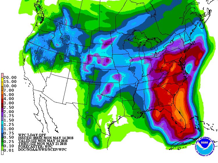
NOAA's forecast map of total rainfall amounts over the next seven days...excessive levels are predicted throughout the eastern third of the nation; map courtesy NOAA
Excessive rainfall threat continues for the second half of the week and weekend
With the frontal system in close proximity, additional showers and thunderstorms are likely from mid-week through the weekend and even into the early part of next week. To make matters worse, tropical moisture from the Southeast US will push northward and get intertwined into our overall wet weather pattern here in the Mid-Atlantic.
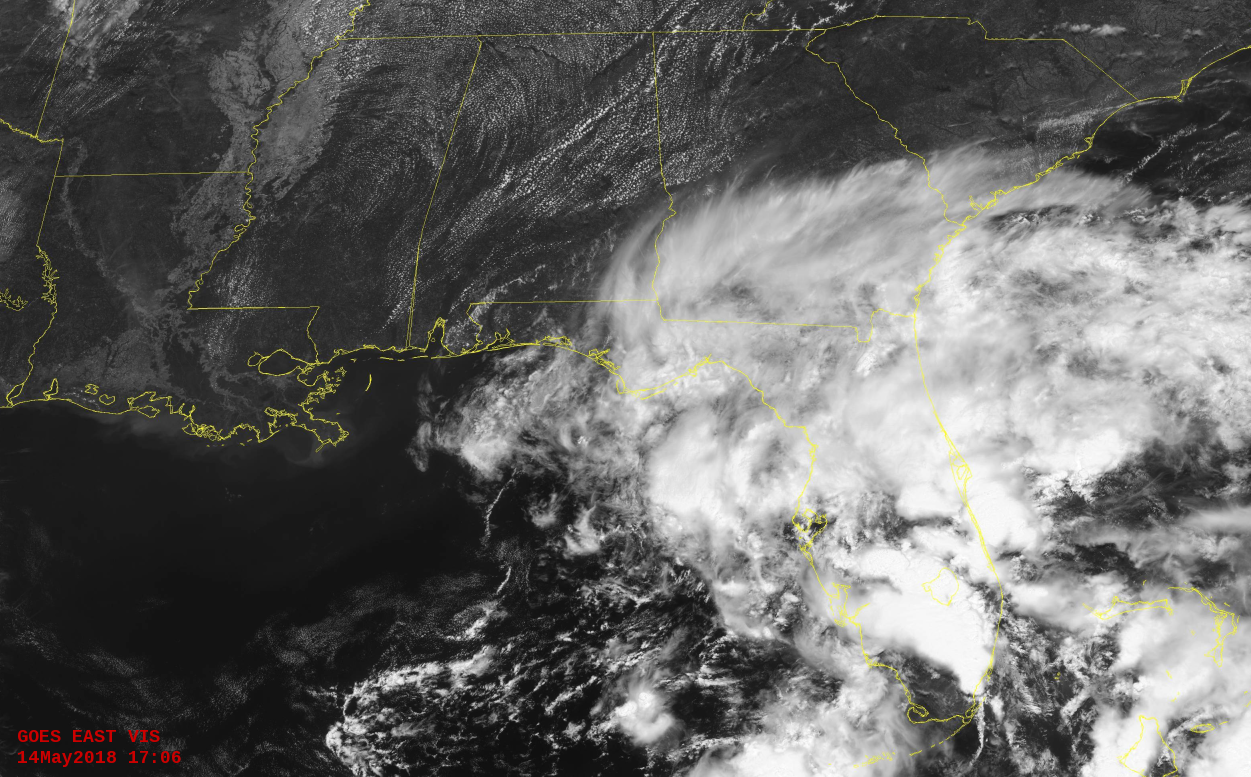
Latest visible satellite view of the Southeast US with tropical moisture impacting Florida. This moisture will push northward over the next few days and contribute to excessive rainfall amounts over the next week or so in much of the eastern third of the nation; image courtesy NOAA/GOES, Penn State eWall
A tropical low pressure system is intensifying today over the eastern Gulf of Mexico and it is pushing tropical moisture into Florida and this abundant moisture will eventually make it as far north as the Mid-Atlantic region. Consequently, the threat for excessive rainfall will continue here from mid-week into early next week and flash flooding may become a real concern.
Meteorologist Paul Dorian
Vencore, Inc.
vencoreweather.com
Extended morning video discussion on the excessive rainfall and severe weather threat: