1:15 PM | **"Clipper" snow on Wednesday...major coastal storm threat for Saturday**
Paul Dorian
Discussion
An all-out snowstorm is on the table for the I-95 corridor region from DC-to-Boston this weekend, but that system is several days away and we have to deal with a “clipper” system in the short-term. A fast-moving “clipper” system is indeed dropping southeastward today from the Northern Plains towards the Mid-Atlantic region and accumulating snow is likely tomorrow across much of the I-95 corridor. This low pressure system will intensify quickly upon reaching the relatively warm coastal waters of the western Atlantic Ocean and this could enhance snowfall amounts in Delaware and southern New Jersey late Wednesday. The specifics on the forecast for tomorrow by region follow:
DC Accumulations of a coating to a couple of inches possible in the District and points to the north…little or no accumulations are expected in the nearby locations just to the south of the District. Snow begins early tomorrow morning and can be mixed with rain at times; especially, just to the south and east of the District. The heaviest snow should come in the period from mid-to-late morning through mid-afternoon. Precipitation winds down late tomorrow afternoon. The morning commute can be impacted by this weather scenario and there can be some residual effects on the evening commute.
Philly Accumulations of a coating to a couple of inches are possible by late tomorrow evening. Snow begins during the mid-to-late morning hours and continues into the evening. Rain can mix in at the onset in areas from Philly south and east, but this should become primarily a snow event. The morning commute is likely to take place before the main action begins, but the evening commute will likely be negatively impacted by the weather. Even higher snowfall amounts are possible across Delaware and South Jersey (perhaps 4 inches or so).
NYC Accumulations of a coating to an inch or so are possible in and around the NYC metro region. Snow is likely in the time period from mid-day into early tomorrow night. The morning commute is likely to take place before the main action begins, but the evening commute will likely be negatively impacted by the weather.
Looking ahead There could be a blockbuster coastal storm this weekend and then another storm threatens the Mid-Atlantic region during the early part of next week. If you are a snow lover, then one of the potential problems with the weekend storm is the fact that there will not be an Arctic air mass in place anchored by strong high pressure - usually a requirement for a snowstorm around these parts. However, it is possible for a strong storm to “generate” its own cold air and that could end up being the case here. Stay tuned, still a long way to go.
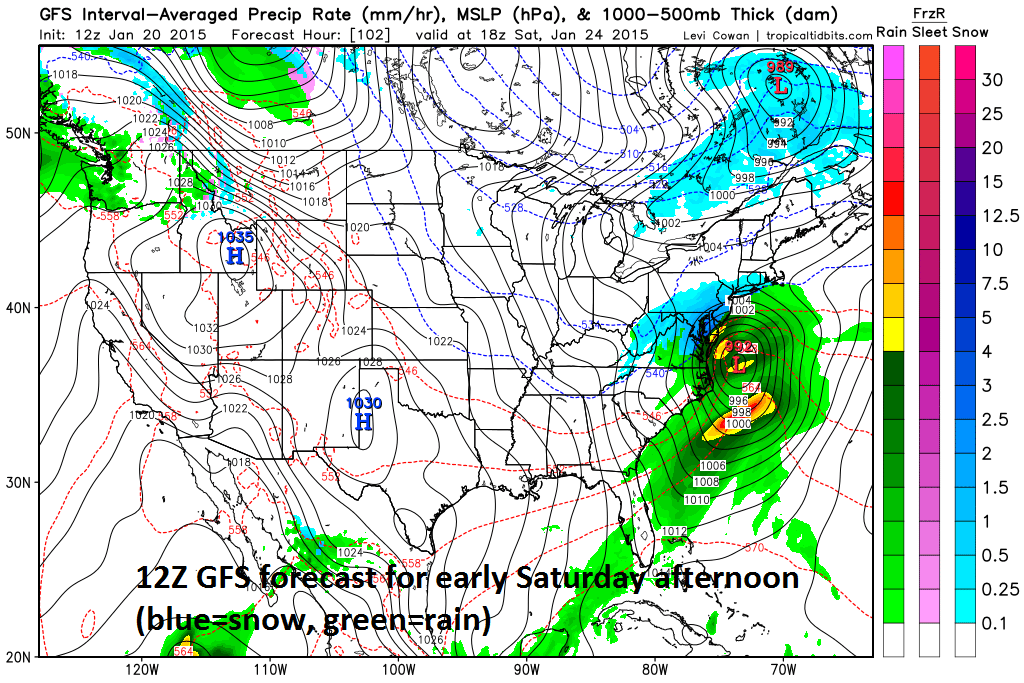 [12Z GFS forecast map for early Saturday afternoon; courtesy tropicaltidbits.com]