12:45 PM | **An update on today's serious severe thunderstorm threat and on the latest solar storm**
Paul Dorian

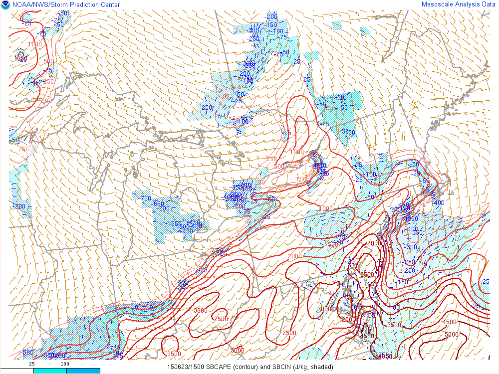 [Current Convective Available Potential Energy (CAPE) index values; courtesy NOAA]
Discussion
Severe weather threat Severe weather indices are often quite useful to weather forecasters in the determination of atmospheric instability and several of these are raising serious red flags for the I-95 corridor for later today/early tonight. One such index is called Convective Available Potential Energy (CAPE) and readings above 2500 are considered to be “extreme” and suggestive of a very unstable atmosphere. Currently, CAPE readings (above) exceed 3000 in much of the area from DC eastward to southern New Jersey and northward into southeastern Pennsylvania. In addition, the Lifted Index (LI) is typically regarded as indicative of “extreme instability” when calculated at -8 or less and the current map (below) shows “extreme” levels of -8 or -9 in the same general region from DC eastward to southern New Jersey and northward into southeastern Pennsylvania. All of this makes the entire Philly metro region, southern New Jersey, the DC metro region, and the Delmarva Peninsula especially vulnerable late today/early tonight to some nasty thunderstorm activity. The timetable for the potential severe thunderstorm activity is the usual summertime "prime time" period of 5-9pm. Any thunderstorm later today/early tonight in the I-95 corridor can contain torrential downpours with flash flooding, frequent lightning with possible power outages, damaging wind gusts, hail and there can even be isolated tornadoes during this event.
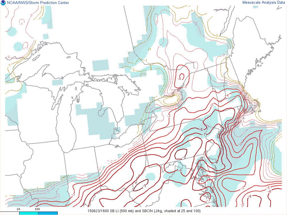 [Current Lifted Index (LI) values; courtesy NOAA]
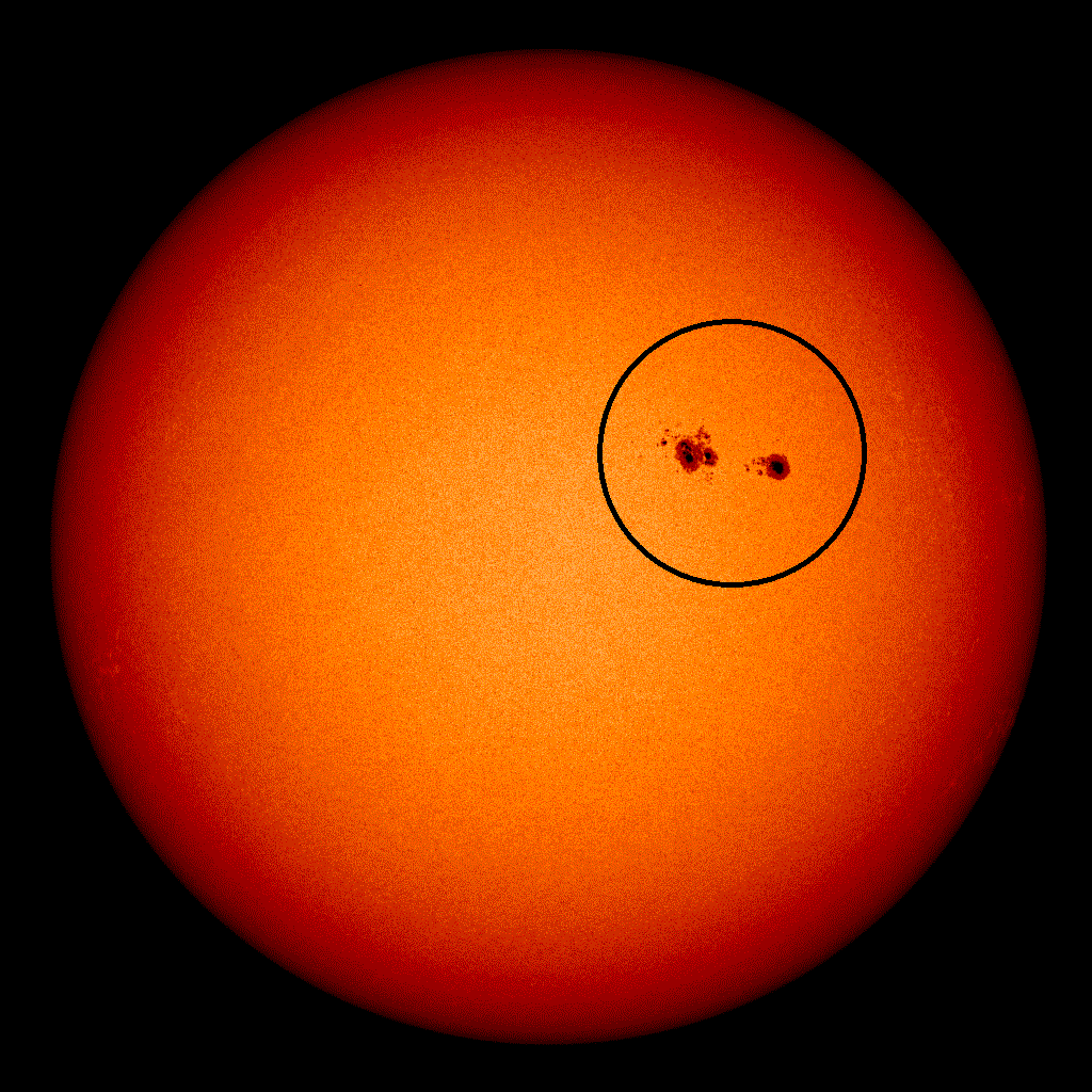
 [Latest solar image with active sunspot region circled; courtesy NOAA]
Solar storm In addition to the lower atmosphere instability being experienced today in the Mid-Atlantic region, the upper atmosphere around here and all the way to the North Pole has been affected by a series of coronal mass ejections (CMEs) since Sunday which created northern lights last night as far south as Georgia. In general, the latest image of the sun (above) is actually rather quiet-looking except for one large and active sunspot region (circled) that has been directly facing the Earth in recent days and the culprit of this latest solar outburst. The interesting part of the story here is that NOAA modeling of the June 22 CME suggests another outburst will arrive early tomorrow night and this could cause a renewed round of northern lights across many mid and high latitude locations. The lower left image below depicts the Earth as a small green circle (arrow) with lots of "yellows and reds" representing the plasma associated with the recent coronal mass ejection and it has it arriving by around 7pm tomorrow night. Bottom line…if you’re an aurora watcher you might want to check things out tomorrow night (and skies should cooperate) and perhaps even after midnight later tonight when skies should clear following late afternoon and evening thunderstorms.
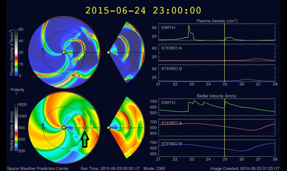 [NOAA forecast model of coronal mass ejection; courtesy NOAA Space Prediction Center]