1:30 PM | **Here we go again...the threat for severe thunderstorms and flash flooding**
Paul Dorian
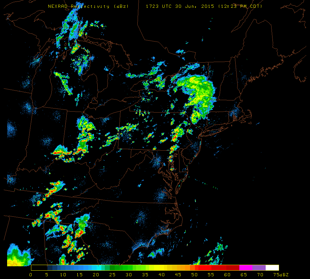 [NEXRAD radar image; courtesy University of Wisconsin]
Discussion
The atmosphere is quite juicy this afternoon and numerous thunderstorms are breaking out just to the west of Route I-95 and some of this activity will spill over into the immediate I-95 corridor region from DC-to-Philly-to-NYC later this afternoon. As low clouds have eroded today, the atmosphere has destabilized rapidly and high dew points have contributed to the firing up of very impressive-looking thunderstorms. Some of these storms will likely reach strong-to-severe levels over the next couple of hours raising the possibility of heavy downpours, damaging wind gusts over 60 mph, hail, frequent lightning and even isolated tornadoes.
One concern this afternoon is the possibility of “training” in parts of the I-95 corridor which occurs when thunderstorms "roll over" the same area in a given short time period. This action could lead to flash flooding as heavy rainfall piles up in a given location from multiple thunderstorm cells. In the I-95 corridor, eastern Pennsylvania is probably the region where “training” is most likely to occur later today. Also, the greatest threat for severe weather will likely occur in much of this same region (i.e., eastern PA) - generally in areas to the north and east of the DC metro region and to the south and west of New York City. The threat for severe weather and flash flooding will continue into the overnight hours and we may have new problems to deal with on Wednesday afternoon.