12:30 PM | **Major coastal storm threat continues for next week...GFS computer forecast model slowly coming around**
Paul Dorian
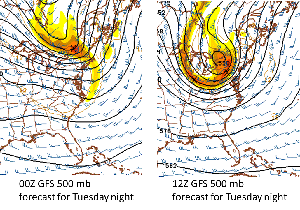 [Big changes at 500 mb between last night's GFS model run and this morning's run (verification time Tuesday night)]
Discussion
Overview The signs continue for a major coastal storm next week and while NOAA’s GFS computer forecast model continues to seemingly underplay this potential threat, it has made some important strides at a more robust solution in line with most other computer forecast models. Indications are that the 500 millibar upper-level pattern will feature blocking high pressure extending from the Northern Plains into southeastern Canada by early next week at the same time upper-level troughing will be digging into the Southeast US. The additional element of a strong upper-level jet streak early next week raises the chances of important intensification of surface low pressure off the coast in the “late Monday/Tuesday” time frame. There will likely also be cold air sitting across New England and southeastern Canada anchored by strong surface high pressure. It is still way too early to know where the rain/snow line would set up for this potential storm in the Northeast US, but odds would favor rain at or near the coastline perhaps with strong winds and coastal flooding, snows in the interior higher elevation locations, and perhaps quite a "battle zone" between rain and snow just to the north and west of Route I-95.
GFS computer forecast model There continue to be some big disagreements amongst the worldwide computer model forecasts, but the NOAA GFS computer forecast model - an outlier so far with a much weaker storm solution - has made some notable changes in its upper-level forecasts for next week that could signal big changes at the surface-level in the next couple of days. Specifically, the 500 and 250 millibar forecasts have changed noticeably for the same verification time (next Tuesday night) between last night’s 00Z model run and this morning’s just 12 hours later (12Z). The all-important upper-level trough of low pressure and associated jet streak are now much more aggressive on the latest GFS model run for next Tuesday night and more conducive to amplification. These upper-level forecast changes likely foretell a coming change at the surface-level by the GFS model in coming days with a much more intense coastal storm - and in line with numerous other forecast models. Stay tuned - someone in the interior Northeast US is liable to get walloped by snow from this storm.
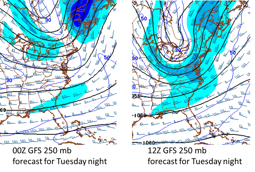 [Big changes at 250 mb between last night's GFS model run and this morning's run (verification time Tuesday night)]
Paul Dorian/Meteorologist VencoreWeather.com now on Facebook, Twitter and liveweatherblogs.com paul.b.dorian@vencore.com