1:45 PM | **Major coastal storm to pound the eastern US**
Paul Dorian

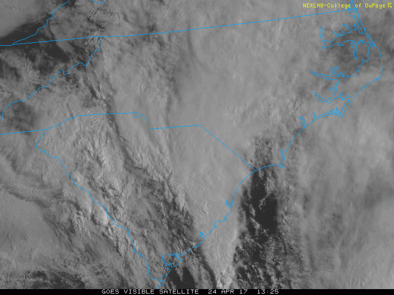
GOES visible satellite imagery loop shows very impressive influx of moisture from the western Atlantic into the developing low pressure area over the Southeast US; loop courtesy College of DuPage, NOAA
Overview
A coastal storm will intensify significantly over the next 12-24 hours and become a major player for the eastern US with heavy rain, strong winds and embedded strong thunderstorms. Deep upper-level low is moving very slowly today across the Southeast US and, as it becomes negatively tilted, a strong jet streak will rotate around and help to set off the rapid intensification of surface low pressure. An impressive influx of moisture is already feeding into this developing storm system from the western Atlantic Ocean and much of this will slowly ride up the eastern seaboard over the next 36 hours or so. The precipitation rate in the DC-to-Philly-to-NYC corridor will increase tonight and bands of heavy rain are likely on Tuesday and Tuesday night along with strong wind gust and cool temperatures.

Water vapor image shows circular area associated with the deep upper-level low near the Georgia/Alabama border (darker region) and an influx of moisture from western Atlantic (blue area); courtesy NOAA
Details
The surface low pressure system developing in the Southeast US will make little progress in the near term in terms of pushing to the north due to some blocking in the upper atmosphere across the Northeast US and western Atlantic. However, by early Tuesday the strengthening low will push northward into the mouth of the Chesapeake Bay and bands of heavy rain are likely to "pinwheel" into the DC-to-Philly-to-NYC corridor from our south and southeast. Winds will also become quite noticeable in the I-95 corridor and can rise to very strong levels (i.e.near hurricane force gusts) just off the Mid-Atlantic coastline at the peak of the storm’s intensity later tomorrow. Thunderstorms are also a possibility in the Mid-Atlantic region as this storm pushes up along the coastline; especially, over the Delmarva Peninsula. Rainfall amounts by the end of the storm can certainly exceed two inches in some parts of the I-95 corridor from this coastal system.

High-resolution (3-km) 12Z NAM computer forecast model shows major storm center pushing into the mouth of the Chesapeake Bay early Tuesday as heavy rain "pinwheels" northward into the I-95 corridor; maps courtesy tropicaltidbits.com, NOAA/EMC
By tomorrow night, this low pressure system will begin to weaken and rain is likely to diminish in the I-95 corridor by the time Wednesday rolls around. Once the storm finally pulls away from the Mid-Atlantic coastline later Wednesday, it’ll turn noticeably milder and then a real warm surge of warm air will boost temperatures here well into the 80’s by the end of the week and weekend.
Meteorologist Paul Dorian
Vencore, Inc.
vencoreweather.com
Extended video discussion: