11:10 AM Tuesday | *****Major coastal storm with significant impact all along the I-95 corridor*****
Paul Dorian

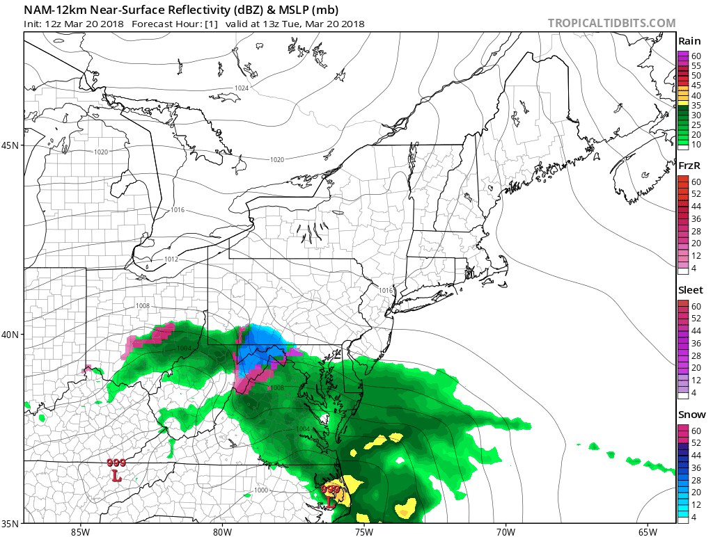
12Z NAM loop of surface-level forecast maps; courtesy NOAA/EMC, tropicaltidbits.com
Overview
Spring will begin with a major coastal storm that will have a significant impact on the I-95 corridor region from DC-to-Philly-to-NYC. Spring officially begins early this afternoon and the weather will be anything but spring-like in the Mid-Atlantic region. Strong, cold high pressure from southeastern Canada has built into the Northeast US and this will be a key player and a cold air source for the Mid-Atlantic region during the upcoming long-lasting and significant weather event. This will be a two-part storm system with an initial wave of low pressure bringing mixed precipitation today and tonight into the I-95 corridor and then a second and stronger storm will form off of the Virginia Capes early tomorrow. It is this system that will generate significant snow accumulations for the DC-to-Philly-to-NYC corridor where more than a foot can pile up by tomorrow night in some sections.
Discussion
Low pressure is over the Ohio Valley at this time and it is generating mixed precipitation south of the PA/MD border and generally snow in areas to the north of the Mason-Dixon Line. Mixed precipitation will likely be the pattern for much of today and tonight in the I-95 corridor though small snow accumulations of up to a couple of inches can develop by tonight in some sections. This initial Ohio Valley low pressure system will then begin to transfer energy to a secondary storm off the Virginia coastline by late tonight and this will become the main player in the I-95 corridor on Wednesday and Wednesday night.

12Z NAM loop of 850 mb temperature forecast maps; courtesy NOAA/EMC, tropicaltidbits.com
As colder air continues to feed in from the north, any mixed precipitation is likely to change to all snow by early tomorrow from southwest-to-northeast so that DC is likely to feature all snow first then Philly and then NYC. Make no mistake about it, this approaching air mass is cold for any time of year and temperatures aloft will drop sharply between this evening and tomorrow evening. That drop in temperatures in the upper atmosphere will lead to relatively high snow-to-liquid ratios as depicted by the “Kuchera” ratio forecast map for tomorrow morning (e.g., greater than 10:1 ratio across much of PA) which will aid in overall accumulations.

Forecast map of "Kuchera" snow:liquid ratio by tomorrow morning (00Z GFS). The higher the ratio, the quicker the snow can accumulate. This is indeed a truly cold air mass that is feeding into this developing storm system and ratios will get quite high on Wednesday (e.g., greater than 10:1 across much of PA). courtesy Pivotal Weather, NOAA/EMC
There is the likelihood for mesoscale snow bands to form on Wednesday with very heavy snow rates possible of a couple inches per hour and these bands may include some “thunder snow”. By tomorrow night, significant snow accumulations of 8-14 inches are likely in the Philly and NYC metro regions and all the way to coastal sections of NJ - and there will likely be locally higher amounts. In the immediate DC metro region, 4-8 inches of snow is likely with locally higher amounts possible in the far northern and western suburbs (e.g., Frederick, MD). An interesting note about the DC snowfall, this is going to be by far their biggest of the "winter season" and it'll officially come in part of the spring. As with most storms in March, elevation is likely to play a critical role with a couple degrees of difference from lower locations potentially having an important impact on snowfall totals.

Winds will become a major factor on Wednesday as the coastal storm intensifies. Gusts to 40 mph inland and 50 mph at the coastline will increase chances for power outages. courtesy weathermodels.com (Dr. Ryan Maue), NOAA/EMC
In addition to the snow, as the secondary storm intensifies near the Mid-Atlantic coastline later tonight and Wednesday, the pressure gradient will tighten and northeast winds will increase noticeably. In fact, there can be gusts to 40 mph or so at inland locations and 50 mph or so at the coastline by later tomorrow during the brunt of the storm. The combination of increasing northeast winds and heavy, wet snow could, unfortunately, lead to some power outages during this long-lasting event. The second and main storm should wind down early Wednesday night and it’ll stay cold later this week and into the weekend and, believe it or not, there may be yet another nor’easter to worry about this weekend or early next week.
During a serious snowstorm of this type, it is important to keep a sense of humor so I recommend that you watch this video:
Meteorologist Paul Dorian
Vencore, Inc.
vencoreweather.com
Extended morning video discussion on the major coastal storm (not humorous):